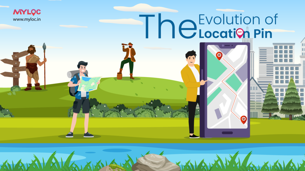
In the conventional era of navigation, people would get their way through paper maps and by relying on the knowledge of the local masses. With the advancement of technology and the Internet, the digital transition has driven more precision when it comes to navigating the world around us.
The Humble Beginnings:
The root of navigation is set back to paper maps. Before the advent of smartphones and GPS, the usual dependence of travellers was on physical maps adorned with landmarks, street names, and coordinates. Locating a specific spot required a keen sense of orientation and a fair amount of time spent on scrutinizing the map.

The Digital transit:
The digital revolution initiated the transition from paper to digital mapping. The early attempt to provide digital addresses for everyone was very fundamental and was restricted to presenting static maps and plotting coordinates. An upgrade to paper maps, the early digital solutions to map any location did not have the interactive and engaging features that are very common today.
The Evolution of GPS:
With the integration of Global Positioning System (GPS) technology into consumer devices, the digital address system had a breakthrough. GPS transformed the way people navigate, providing real-time location data and turn-by-turn directions. The introduction of dedicated GPS devices for cars marked a significant milestone, making navigation more accessible to the masses.
The Smartphone Revolution:
The proliferation of smartphones brought location pinning into the palms of our hands. With mobile applications and services like Google Maps, dynamic and interactive location pins came into the picture. Users could now drop pins, share a location pin with others, and receive real-time directions to pinned locations. This marked a paradigm shift, empowering individuals to hassle-free navigation.
Advent of Digital location pin:
As digital maps became more sophisticated, the concept of the location pin emerged. Initially, a static marker on a map, this digital location pin allowed users to allot a specific location of interest as a reference point for navigation. The early adopters of online mapping services witnessed the convenience of dropping a pin to mark a location, whether it was a meeting point or a favourite restaurant. With applications like Pataa and MyLoc, personalized location services have taken over the concept of digital address. MyLoc elevated the concept of location pinning by introducing customizable pins, allowing users to create unique markers for their homes, workplaces, and favourite spots. The MyLoc pin can be used as a digital address for everyone serving as a navigational aid and becoming a versatile tool for creative and practical utility.
The Accuracy Advantage with Digital Address System:
The modern location services system is a blend of GPS, Wi-Fi, and cellular data to pinpoint the location with exact accuracy. The digital pin, which can be used even without the Internet to share location with others, can provide precise navigation in a bustling city as well as in remote and rustic areas. Soon, this address system will become an indispensable feature of our digital lives.
What is the ‘Future’?
While the evolution of location pins has been transformative, there are still several challenges that need to be resolved. Some of them include – inaccurate mapping data, constant change of urban landscapes, and the need for standardized addressing systems. However, with ongoing advancements in technology, including the integration of augmented reality and machine learning, the future looks promising and will resolve these challenges and take location pinning to new heights.


0 Comments